
arcgis api JavaScript打印地图图例显示不正确
·
问题1:地图上以图层样式以PictureMarkerSymbol的打印不出现或出现被替换
在地图上使用图片图标作为样式,是一件很正常的事情。
打印的时候,在被打印的地图上没有看到这个图层。
反复测试后,并没有找到原因,但是掌握了出现的情况。
背景:查询时将查询结果加载到地图上,其中图标的样式使用小气球图片png格式。
情况一
设置:图层的样式使用PictureMarkerSymbol,生成每一个graphic时,参数symbol为null
打印结果:看不到当前图层情况二
设置:图层是否设置样式都可以,生成每一个graphic时,参数symbol为PictureMarkerSymbol样式
打印结果:可以看到当前图层,但是每一个对象原本的图片图标被替换,替换为arcgis最基本的样式,显示在打印的地图上。解决办法:
将图片样式替换掉,替换为arcgis中SimpleMarkerSymbol的样式
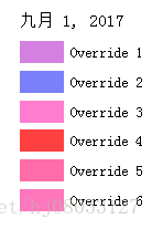
问题2:当图层以colorInfo渲染时,图例显示override
图层使用colorInfo渲染方式
       // parameter
       var lineWidth = config.symbol.lineWidth,
            lineColor = config.symbol.lineColor,
            legendTitle = config.legendTitle,
            // stopsValue = config.renderer.stopsValue,
            stopsNum = config.renderer.stopsNum,
            stopsColor = config.renderer.stopsColor,
            type = config.renderer.type,
            field = config.renderer.field,
            normalizationField = config.renderer.normalizationField;

        var stopsValue = getStopsValue(data, stopsNum);

        // symbol
        var line = new esri.symbol.SimpleLineSymbol().setWidth(lineWidth).setColor(new esri.Color(lineColor));
        var symbol = new esri.symbol.SimpleFillSymbol().setOutline(line);

        var stops = [];
        for (var i = 0; i < stopsValue.length; i++) {
            var b = {
                "value": stopsValue[i],
                "color": new esri.Color(stopsColor[i])
            }
            stops.push(b);
        }

        var r = new esri.renderer.SimpleRenderer({
            symbol: symbol,
            visualVariables: [{
                type: type,
                field: field,
                normalizationField: normalizationField,
                legendOptions: {
                    showLegend: false,
                    title: legendTitle
                },
                stops: stops
            }]
        });
arcgis api v3.21打印出地图上的图例:
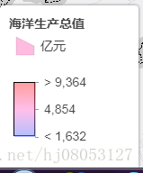
arcgis api v3.21 web系统上的图例:

arcgis api v3.17 web系统上的图例:
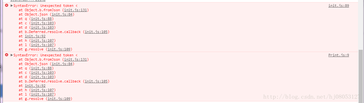
使用arcgis api v3.20及以下的API版本进行打印,都会报错:
有可能是版本带来的问题。待解决。
问题3:
当打印服务和打印的图层不在同一个网段时,则不能打印正确
可以打印
app.printUrl = "https://sampleserver6.arcgisonline.com/arcgis/rest/services/Utilities/PrintingTools/GPServer/Export%20Web%20Map%20Task";
var permitUrl = "https://sampleserver6.arcgisonline.com/arcgis/rest/services/PoolPermits/MapServer/1";
打印失败
app.printUrl = "https://sampleserver6.arcgisonline.com/arcgis/rest/services/Utilities/PrintingTools/GPServer/Export%20Web%20Map%20Task";
var permitUrl = ""http://172.16.1.183:6080/arcgis/rest/services/js/8"";
问题4. 发布图层使用图片图标,地图和图例均可以正确显示
地图在发布时就使用图片,则发布后的地图可以被正确打印,地图上图标没有发生变化,图例也是正确的。
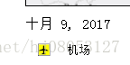
以机场图层为例,图例正确:
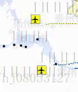
地图正确:(忽略文字乱码)
问题5. 中文标注乱码
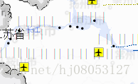
以机场图层为例,乱码部分本应该是图层的标注名称。待解决
图层本身没有标注,增加了labelLayer图层,给图层增加标注

加入社区!打开量化的大门,首批课程上线啦!
更多推荐



 0
0 0
0- 0


 已为社区贡献1条内容

所有评论(0)